
Weston Crime Rates
Like all Toronto neighbourhoods, there is crime in Weston. For the purposes of clarity, the crime rates are broken down by area, using streets in the neighbourhood as boundaries. However, it is important to recognize that criminals do not stop at predefined boundaries when they are looking to commit crimes. Therefore, it is important to focus on crime in the entire region (as well as crime in the surrounding Toronto neighbourhoods when trying to determine the level of crime in any specific area. Here are the rates of crime in Weston. All rates are measured per 1000 living and working in the region.| Region | Crime Against People in Weston | Crime Against Property in Weston |
| Bordered by Highway 401, Jane Street, Humber River, Woodward Avenue Queenslea Avenue & Oak Street | 7.94 per 1000 | 33.7 per 1000 |
| Bordered by Oak Street, Humber River, Railway Tracks, Lawrence Avenue | 14.97 per 1000 | 33.72 per 1000 |
| Bordered by Woodward Avenue/Queenslea Avenue, Jane Street, Lawrence Avenue, Railway Tracks | 12.72 per 1000 | 25.93 per 1000 |
| Bordered by Denison Road, Railway Tracks, Margaret Rose Crescent, Roman Way Crescent | 10.45 per 1000 | 14.92 per 1000 |
| Bordered by Lawrence Ave, Jane Street, Humber River, Clouston Avenue (excluding region listed directly above) | 16.08 per 1000 | 29.14 per 1000 |
| Bordered by Clouston Avenue, Eglinton Avenue, Jane Street, Humber River | 9.35 per 1000 | 11.19 per 1000 |
Weston Crime
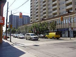
The Lawrence Avenue and Weston Road intersection remains a focal point for community safety discussions, with the area around 1765 Weston Road historically experiencing higher incident rates due to concentrated high-rise housing and increased foot traffic. Property crime—particularly auto theft and break-and-enter incidents—affects both residential complexes and the commercial corridor along Weston Road’s main shopping district between Church Street and Wilby Crescent.
Personal safety concerns have been highlighted by recent incidents, including a March 2025 sexual assault near St. Clair Avenue West and Weston Road where a woman was attacked while walking home from work around 9:30 p.m. The suspect fled into a nearby forested area, underscoring the importance of well-lit pedestrian routes and visible security measures in areas with limited natural surveillance.
Community organizations including the Weston Residents Association have actively engaged with Toronto Police Services to address safety concerns through environmental design improvements, increased street lighting, and neighbourhood watch programs. The area’s ongoing revitalization efforts aim to enhance both actual and perceived safety through economic development and community investment.