• Mon - Fri: 8:30am - 8:00pm
  • Sat: 11am - 4:00pm
  • 1-888-939-3733

Neighbourhood Crime Reports

O’Connor-Parkview Crime Report
O’Connor-Parkview is a Toronto neighbourhood that is located in the East York area of the city. This neighbourhood can be further broken down into Topham Park, Woodbine Gardens and Parkview Hills. The overall O’Connor-Parkview neighbourhood is located southeast of the Don Valley. It is bordered by Taylor-Massey Creek in the south, Victoria Park Avenue in the east and Holland Avenue in the north. Topham Park is the area that is bordered by Victoria Park Avenue in the east, Holland Avenue in the north, Westview Boulevard in the west and St. Clair Avenue in the south. Woodbine Gardens is bordered by St. Clair Avenue in the north, O’Connor Drive in the west, Victoria Park Avenue in the east and Taylor-Massey Creek in the south. Parkview Hills is bordered by the Don Valley in the north and west, Westview Boulevard and O’Connor Drive in the east and Taylor-Massey Creek in the south. Schools in the area include Crescent Town Elementary School and Presteign Heights Elementary School.

O’Connor–Parkview Crime Rates & Crime Statistics

The three regions inside the O’Connor-Parkview neighbourhood each have their own characteristics and structure that separates them from one another. There are a wide variety of different structures within the neighbourhood, from high-rise buildings to smaller bungalows to two-storey houses. Here are the O’Connor-Parkview crime rates against people and property. All rates are per 1,000 living and working in the area.
Region Crime Against People in O’Connor–Parkview Crime Against Property in O’Connor–Parkview
Bordered by Holland, Victoria Park, O’Connor, St. Clair (Topham Park Area) 8.58 per 1000 15.89 per 1000
Bordered by St. Clair, Rexleigh Drive, Glen Albert Drive, Cedarcrest Boulevard, Gower Street, Victoria Park 13.99 per 1000 18.71 per 1000
Bordered by Gower, Victoria Park, Dawes Road, Taylor-Massey Creek 8.08 per 1000 18.25 per 1000
Bordered by St. Clair, Rexleigh, Glen Albert, Cedarcrest, Gower, Dawes, Taylor Massey, St. Clair 6.41 per 1000 12.47 per 1000
Bordered by Northline, Don Valley O’Connor, Curity Avenue, Denvale Road, Doris Drive 3.33 per 1000 11.15 per 1000
Bordered by Don Valley, Curity, Denvale, Doris, St. Clair, Taylor-Massey Creek 4.32 per 1000 6.43 per 1000

O’Connor–Parkview Crime

In February 2011, a man was stabbed in the Woodbine Gardens area. From the Toronto Star:
A man is in hospital after being found with multiple stab wounds by police officers in Woodbine Gardens. Police responded to a call around 9:20 p.m. on Dawes Rd., north of Danforth Ave. and found a man who was reportedly stabbed several times in the back.
In October 2008, five people were stabbed in the St. Clair and O’Connor area. From CTV News:
A fight at a post-football-game party in East York left five people stabbed, including one critically wounded, in one of several violent incidents in Toronto overnight. The incident occurred at a home on Parkview Hill Crescent, which is in the St. Clair Avenue and O’Connor Drive area, at 10:20 p.m. Police say an uninvited guest showed up at the party. When officers arrived, they found five young men who had been stabbed. Some were high-school age, and others were slightly older.
In January 2008 a teenager was stabbed in the Parkview Hills area. From City TV:
Police received a call from a woman saying her friend had been stabbed in the stomach and they rushed to the Bermondsey Rd. and North Line Blvd. area at around 6 p.m. But once they arrived authorities couldn’t find the victim or the caller. Not long after the witness again spoke to a dispatcher and police redirected their focus to the Parkview Hill neighbourhood. The victim was then found lying on the sidewalk near corner of Northdale Blvd. and Denvale Rd.
More neighbourhood crime reports.
Read more
Humbermede Crime Report
humbermede-emery-crime-reportHumbermede, also known as Emery, is a Toronto neighbourhood that is located near the Humber River, as the name suggests. The neighbourhood’s boundaries are Finch Avenue in the north, Sheppard Avenue in the south, the Humber River in the west and Highway 400 in the east. The neighbourhood consists primarily of single-family homes, but there are also some high-rises in the area. Notable schools in the area include Emery Collegiate, Gulfstream Public School and St. Jude Catholic School. Nearby neighbourhoods include York University Heights in the east.

Humbermede Crime Rates & Crime Statistics

Analyzing crime in any particular area requires a great deal of information and critical thinking. While crime rates generally vary from region to region, for statistical purposes streets are often used as dividers to break up a neighbourhood. This can provide a guide as to which regions have more crimes than others, but it should not be taken as an absolute fact. Criminals do not stop at artificial neighbourhood or region boundaries. For example, living across the street from a region with a high rate of property crime could likely be safer than living directly in that region, but it doesn’t mean that criminals won’t cross the street to commit crimes from time-to-time. It is also important to take a look at the crime rates of neighbouring areas to give yourself a general overview and a point of comparison. Taking all of these factors into account will allow you to accurately judge the crime rates for a Toronto neighbourhood. Keep in mind that crime can take place at any time, even in the safest neighbourhood, so having a reliable home security system is incredibly important. Here are the Humbermede crime rates against people and property. All rates are per 1,000 living and working in the area.
Region Crime Against People in Humbermede/Emery Crime Against Property in Humbermede/Emery
Bordered by Finch, Humber River, Saint Lucie Park, Lanyard Road, Rumike Road 7.18 per 1000 8.67 per 1000
Bordered by Finch, Lanyard Road, Rumike Road & just east of Weston Road 10.71 per 1000 23.99 per 1000
Bordered by Finch, 400, Sheppard, Humber River, Saint Lucie Park 6.53 per 1000 12.88 per 1000

Humbermede Crime

In March 2012, a man was shot outside a banquet hall in the Humbermede/Emery area. From Global TV:
Police are searching for suspects after a man was shot outside a banquet hall in North York. Police were called to 800 Arrow Rd., in the Weston Rd and Finch Ave area, shortly after 2 a.m. Thursday. It is reported that the victim was leaving a dance when he was approached by an unknown group of males.
In October 2011, a man was stabbed in the chest in the Sheppard Avenue and Weston Road area. From City TV:
A man is recovering after he was stabbed in the chest near a nightclub in the Sheppard and Weston Road area Monday morning. The attack happened just before 3 a.m. at Rivalda Road, near Las Brisas del Mar nightclub. The victim, a 26-year-old man, was rushed to hospital with a single stab wound to the chest. His injuries are said to be non-life threatening. Police say the victim was approached by a group of men when he was leaving the club. He tried to run away, but later realized he had been stabbed.
In February 2011, a man was shot and killed near Weston Road and Finch Avenue. Also, from CityTV:
A 55-year-old man was declared dead on the scene after a shooting at 2400 Finch Avenue West, near Weston Rd., Tuesday night. The victim was reportedly shot in the chest at around 9:15pm. When paramedics arrived he was without vital signs and couldn’t be revived.
In September 2010, a man was shot in a robbery near Finch and Weston. From CTV:
A 24-year-old man was taken to hospital in stable condition Monday evening after an attempted robbery at a store near Finch Avenue and Weston Road. The shooting reportedly took place at a cellphone store where the victim is employed, in the 2500-block of Finch Avenue West. Police at 31 Division say one shot was fired and there are two male suspects. They say they don’t know which direction the suspects went when they fled the store. There is also no word whether they made off with anything. One of the suspects is presumed to be armed.
In February 2009, a student was stabbed near Emery Collegiate Institute. From the Toronto Star:
A male student was found stabbed in the neck near Emery Collegiate Institute in North York early this afternoon. Police responded to the call at around 12:30 p.m. They found the victim in a field near the school at Finch Ave. W. and Weston Rd. with wounds to the neck and lip.
More neighbourhood crime reports.
Read more
Hillcrest Village Crime Report
Hillcrest Village Crime ReportHillcrest Village is a Toronto neighbourhood that is located in the North York area of the City of Toronto. It is located just north of Don Valley Village. The Hillcrest Village boundaries are Finch Avenue in the south, Steeles Avenue in the north, Leslie Street in the west and the Don Valley Parkway in the east. Don Mills Road runs through the centre of the neighbourhood. Hillcrest Village should not be confused with the small neighbourhood of Bracondale Hill, which is sometimes known as “Hillcrest.” This neighbourhood is located near Casa Loma and is unrelated to Hillcrest Village.

Hillcrest Village Crime Rates & Crime Statistics

Here are the Hillcrest Village crime rates against people and property. All rates are per 1,000 living and working in the area.
Region Crime Against People in Hillcrest Village Crime Against Property in Hillcrest Village
Bordered by Duncan Creek, Don Mills Road, Steeles Avenue 0 per 1000 10.38 per 1000
Bordered by Duncan Creek, Leslie Street, Don Mills Road, Finch Avenue 11.62 per 1000 13.64 per 1000
Bordered by Steeles, Highway 404/DVP, Don Mills, north of Highland Memory Gardens 4.69 per 1000 5.68 per 1000
South of (and including) Highland Memory Gardens, bordered by Don Mills, Finch, 404 1.63 per 1000 5.5 per 1000
Crime statistics in nearby Don Valley Village should be analyzed as well when attempting to get a complete picture of crime in the area.

Hillcrest Village Crime

In November 2011, a teenage girl was allegedly sexually assaulted in the Don Mills and Steeles area. From 680 News:
Toronto police are asking for public assistance identifying a man after a teenage girl was allegedly sexually assaulted on a TTC bus. Police report the 16-year-old girl was assaulted by a male passenger Monday on a bus near Steeles Avenue and Don Mills Road. It’s alleged the man then got off the bus at the Finch Subway Station.
In May 2011, a man was shot in the Finch Avenue and Don Mills Road area. From the Toronto Star:
Police are looking for two teens suspected of a shooting in a residential neighbourhood in North York early Monday morning. A man in his 20s was shot once in the leg in the vicinity of Rameau Dr. and Brahms Ave., near Finch Ave. E. and Don Mills Rd., around 4:30 a.m. The victim said he was shot in Skymark Park, although no evidence of the shooting was recovered. Despite his injuries, he managed to get himself to North York General Hospital, where emergency services notified police.
In September 2009, a man was shot and killed in the Leslie and Finch area. Also from the Toronto Star:
Sheldon Anthony Henry, 23, of Toronto was pronounced dead when EMS arrived at a housing complex on Field Sparrow Way, near Leslie St. and Finch Ave. E., around 9 p.m. Residents heard two gunshots ring out and witnesses told police they saw a lone gunman flee the low-rise building’s lobby, heading south on a walkway towards Finch.
Read more
Little Portugal Toronto Crime Report
little-portugal-toronto-crimeLittle Portugal is a Toronto neighbourhood that is located in the west end of what is sometimes known as “Old Toronto.” The neighbourhood’s boundaries are College Street in the north, Lansdowne Avenue in the west, Ossington Avenue in the east and Queen Street and the CNR/CPR mainline railway tracks in the south. The area in the west of the neighbourhood, between Dufferin Street and Lansdowne is part of a Toronto neighbourhood known as Brockton Village. As the Little Portugal name suggests, a number of Portuguese businesses and residents call the area home. Most Portuguese businesses and storefronts are located along the neighbourhood’s major streets such as Dundas Street West and College Street. The remaining streets are mostly residential, with a number of single-family homes in the region. There are a number of schools within the Little Portugal neighbourhood including Shirley Street Public School, Alexander Muir/Gladstone Avenue Public and St.Helen’s Catholic School. McCormick Recreation Centre and Arena is also located with the Little Portugal neighbourhood.

Little Portugal, Toronto Crime

When analyzing the crime of an area, it is also important to look at the surrounding neighbourhoods to get a clear picture of crime in the entire region. Criminals do not stop at neighbourhood boundaries which are just streets in many cases. Neighbourhoods near the Little Portugal neighbourhood include Trinity-Bellwoods, Dufferin Grove, Parkdale and Queen West. Here are the Little Portugal crime rates against people and property. All rates are per 1,000 living and working in the area.
Region Crime Against People in Little Portugal Crime Against Property in Little Portugal
Bordered by Ossington, Dundas, Queen, Dovercourt Road 6.02 per 1000 24.09 per 1000
Bordered by Ossington, College, Dundas, Dovercourt 6.5 per 1000 25.07 per 1000
Bordered by College, Dundas, Dovercourt, Dufferin 5.69 per 1000 18.03 per 1000
Bordered by Dovercourt, Queen, Dundas, Dufferin 8.48 per 1000 22.48 per 1000
Bordered by Dundas, Dufferin, Lansdowne & the Railway Tracks 11.22 per 1000 27.25 per 1000
Bordered by College, Dovercourt, Dundas & Brock Avenue 5.69 per 1000 18.03 per 1000
Bordered by Brock, College, Dundas & Lansdowne 8.69 per 1000 23.22 per 1000

Little Portugal, Toronto Crime

In August 2008, a shooting took place on Ossington, between between Argyle and Humbert. From BlogTO:
Ossington between Argyle and Humbert is roped off by police tape this morning following a four car gun battle. According to police I spoke to, witnesses reported seeing two Chevy Impalas and a BMW chasing a Honda along Argyle, down Ossington and onto Queen, leaving a spray of bullet casings along the way
In November 2009, a man was shot in the Dundas and Dufferin area. From the Toronto Star:
A man is in hospital after being shot in the thigh near Dundas St. W. and Dufferin St. early Saturday morning. The victim was in the vicinity of Beaconsfield Ave. around 3 a.m. when he got into a dispute with another individual and was shot, said Toronto police.
Read more
Weston Toronto Crime Report
Weston is a Toronto neighbourhood that is located within the former City of York. The neighbourhood’s boundaries include Highway 401 in the north, the Humber River in the west, Jane Street in the east and Eglinton Avenue in the south. Lawrence Avenue runs through the neighbourhood and the region’s core is based along that street. Weston was once an independent town (named “the Town of Weston”) before it became part of York and subsequently the City of Toronto. Due to this fact, there are many streets (such as Church Street, King Street and John Street) that are duplicates of street names in downtown Toronto. Weston is home to many small businesses and other services as well as a variety of single family homes, apartments and condominium towers. The area’s main shopping district is located just south of Lawrence Avenue, on Weston Road between Church Street and Wilby Crescent. The neighbourhood is also home to Cruickshank Park in the Humber River valley. Weston crime statistics

Weston Crime Rates

Like all Toronto neighbourhoods, there is crime in Weston. For the purposes of clarity, the crime rates are broken down by area, using streets in the neighbourhood as boundaries. However, it is important to recognize that criminals do not stop at predefined boundaries when they are looking to commit crimes. Therefore, it is important to focus on crime in the entire region (as well as crime in the surrounding Toronto neighbourhoods when trying to determine the level of crime in any specific area. Here are the rates of crime in Weston. All rates are measured per 1000 living and working in the region.
Region Crime Against People in Weston Crime Against Property in Weston
Bordered by Highway 401, Jane Street, Humber River, Woodward Avenue Queenslea Avenue & Oak Street 7.94 per 1000 33.7 per 1000
Bordered by Oak Street, Humber River, Railway Tracks, Lawrence Avenue 14.97 per 1000 33.72 per 1000
Bordered by Woodward Avenue/Queenslea Avenue, Jane Street, Lawrence Avenue, Railway Tracks 12.72 per 1000 25.93 per 1000
Bordered by Denison Road, Railway Tracks, Margaret Rose Crescent, Roman Way Crescent 10.45 per 1000 14.92 per 1000
Bordered by Lawrence Ave, Jane Street, Humber River, Clouston Avenue (excluding region listed directly above) 16.08 per 1000 29.14 per 1000
Bordered by Clouston Avenue, Eglinton Avenue, Jane Street, Humber River 9.35 per 1000 11.19 per 1000

Weston Crime

In March 2012, shots were fired in the Weston Road and Lawrence Avenue area. From the Toronto Star:
Police were called to 1 Hickory Tree Rd. near Weston Rd. and Lawrence Ave. W. at 3:20 a.m. Sunday after residents reported hearing five to eight shots. So far, police have found evidence of five shots to windows. There are no injuries reported.
In January 2012 a man was shot several times in the Weston Road and Highway 401 area. From the Toronto Star:
Police and the SIU are investigating after a man suffered multiple gunshot wounds at a North York plaza during a shooting involving Toronto police. The incident took place Friday afternoon at Crossroads Power Centre, a commercial plaza on Weston Rd. just south of Hwy. 401. Const. Wendy Drummond said police were called after reports of a person with a knife around 12:30 p.m. But no other details were available from police as the provincial Special Investigations Unit is now involved. An SIU forensics van was seen parked on Weston Rd. and at least a dozen police cruisers behind The Beer Store, which is attached to a Subway restaurant and Tim Hortons in the northwest corner of the plaza parking lot.
In September 2010, two people were killed in a shooting in the Weston Road and Lawrence area. From the Toronto Sun:
Two male victims were rushed to Sunnybrook hospital after shots rang out in front of a highrise apartment complex at 1765 Weston Rd., south of Lawrence Ave., shortly before 10:30 p.m. One victim was shot in the head and the other in the abdomen, Toronto Police Staff-Sgt. Mark Barkley told the Toronto Sun late last night. EMS staff confirmed one of males was pronounced dead, but did not specify which one. The second victim arrived at hospital in serious condition but died later from his injurues.
In May 2010 a woman was stabbed and killed in the Lawrence and Jane area. From City TV:
A woman believed to be in her early 30s was reportedly stabbed to death near Jane and Lawrence on Monday afternoon. Police rushed to an apartment at 15 Harding Avenue, where the victim was pronounced dead at the scene. Initial reports suggested the woman may have spent many hours with her paralyzed son in the apartment before anyone responded to the scene.
Read more
Little India Gerrard Street East Crime Report
Little India is a Toronto neighbourhood that is located along Gerrard Street East. The boundaries of this neighbourhood at Greenwood Avenue in the west and and Coxwell Avenue in the east. The area is one of the Toronto neighbourhoods with the most property crime. The region is named “Little India” due to the the many Indian, Pakistani, Bangladeshi, Afghan and Sri Lankan restaurants, cafés and stores in the area. The neighbourhood is sometimes known as the “Gerrard India Bazaar,” “Little Pakistan,” or “Little South Asia.” There are a number of events in the region that appeal to the different South Asian groups, including Diwali and Eid ul-Fitr festivals. The Festival of South Asia takes place in July each year in the neighbourhood. Gerrard Street is typically closed to traffic during the festival, but all businesses remain open as usual. Little India, Gerrard Street East Crime Report

Little India/Gerrard Street East Crime Rates

In the area along Gerrard Street East, between Greenwood Avenue and Coxwell Avenue, here are the averages for crime against people per 1000 living and working in the region and crime against property for 1000 living and working in the region.
Crime Against People in Little India Crime Against Property in Little India
11.89 crimes against people per 1000 living and working in the region 26.56 crimes against property per 1000 living and working in the region

Little India/Gerrard Street East Crime

In July 2009, a shooting occurred in the Gerrard and Greenwood area. From the Toronto Star:
Police are looking for several suspects following a shooting in Toronto’s east end in which a gunman lost his firearm in the road when the car he was firing from hit a speed bump. No one was reported injured after residents heard about a dozen gunshots at a townhouse complex on Walpole Ave., near Gerrard St. E. and Greenwood Ave., just after 8 p.m. Two men were taken into custody when they were stopped by police as they walked along Monarch Park Ave. several blocks from the shooting. Numerous witnesses who were outside enjoying a mild summer evening watched as a group of people scattered when the gunfire broke out.
In July 2010, a man was stabbed near Coxwell and Gerrard. Also from the Toronto Star:
A man is recovering from a stab wound to the abdomen after a bar fight erupted in the city’s east end early Saturday. Police were called to Coxwell and Danforth Aves. around 2:30 a.m., where they found the 25-year-old victim suffering from the stab wound. Investigating officers says that the incident stemmed from an altercation at a bar near Coxwell Ave. and Gerrard St. E.
Read more
Newtonbrook Toronto Crime Report
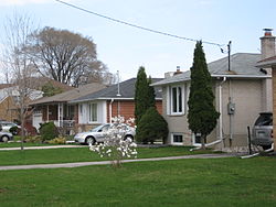
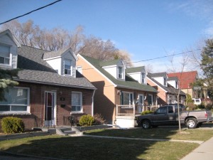
Newtonbrook is a Toronto neighbourhood that is located in the North York area of the city. The neighbourhood’s boundaries are Steeles Avenue in the north, Bathurst Street in the west, Bayview Avenue in the east and just north of Finch Avenue in the south. The neighbourhood is roughly centered around Yonge Street. Newtonbrook was an independent municipality in the 19th century. The neighbourhood was subdivided and redeveloped in the 1950s and a number of single detached or semi-detached houses were built. Many of these homes have since been demolished and larger homes or townhouse complexes have been built in their place. The neighbourhood is home to Newtonbrook Plaza, Centerpoint Mall, Cummer Park Fitness Centre and Esther Shiner stadium as well as Saint Agnes Catholic School and Newtonbrook Secondary School. Newtonbrook_crime_statistics
Newtonbrook Crime Rates

In order to truly capture the crime statistics of a region, it is important to not just consider the specific region in question, but the surrounding areas as well. In the case of Newtonbrook, nearby Willowdale should also be taken into account, among other areas. The Newtonbrook neighbourhood can be broken down into two regions. The area west of Yonge Street is known as Newtonbrook West while the area east of Yonge is considered Newtonbrook East. In the region bordered by Steeles Avenue in the north, Bathurst Street in the west, Drewry Avenue in the south and Chelmsford Avenue and Village Gate in the east, there is an average of 6.35 crimes against people per 1000 living and working in the region. There is an average of 18.65 crimes against property per 1000. South of Drewry Avenue, in the area bordered by Drewry, Bathurst Street, Finch Avenue and Yonge Street, there is an average of 6.53 crimes against people and 21.48 crimes against property. The area bordered by Chelmsford Avenue in the west, Drewry Avenue in the south, Yonge Street in the east and Pleasant Avenue and Moore Park Avenue in the north sees an average of 6.53 crimes against people per 1000 and 15.82 crimes against property. North of Pleasant Avenue and Moore Park Avenue to Steeles, still between Yonge and Chelmsford/Village Gate, there is an average of 5.86 crimes against people and 32.41 crimes against property. East of Yonge Street, in the area bordered by Steeles, Yonge, Bayview and Newton Drive, there is an average of 6.27 crimes against people and 12.2 crimes against property. South of Newton Drive to Cummer Avenue, there is an average of 5.39 crimes against people and 16.11 crimes against property. In the region south of Cummer to Finch, between Yonge Street and Bayview Avenue, there is an average of 3.27 crimes against people and 9.56 crimes against property.

Newtonbrook Crime

In October 2011, a woman was shot and killed by Toronto Police on Wedgewood Drive near Yonge Street and Cummer Avenue. From CBC News:
Ontario’s police watchdog is investigating after a Toronto officer shot a 52-year-old woman dead at a north Toronto home Friday morning. The woman, identified as Sylvia Klibingaitis, was shot in the chest at around 9:30 a.m. outside a home at 51 Wedgewood Dr., near Yonge Street and Finch Avenue. She was rushed to Sunnybrook hospital with serious injuries and was pronounced dead on arrival. Klibingaitis, who lived with her 83-year-old mother, was reportedly threatening an officer with a knife. Police were responding to a call at the address.
In June 2011, a man was stabbed in the Bathurst and Steeles area. From the Toronto Star:
A man was stabbed in the back Wednesday night near Bathurst and Steeles. The 29-year-old was found lying in the lobby of 775 Steeles Ave. West near Bathurst St. with his girlfriend by his side. Police got the call around 10:30 p.m. They don’t yet know whether the stabbing occurred in the building. There are no suspects at this point.
A teenager was stabbed in the Drewry Avenue and Rodeo Court area in January 2011. Also from the Toronto Star:
Police have a suspect in custody after a 17-year-old was stabbed three times at an apartment complex in North York. Emergency crews were called to a building in a residential neighbourhood at Drewry Ave. and Rodeo Ct.
Read more
Earlscourt Crime Report
Earlscourt is a Toronto neighbourhood that is located along St. Clair Avenue. The neighbourhood’s boundaries are Dufferin Street in the east, Old Weston Road and Caledonia Park Road in the west, Rogers Road in the north and Davenport Road in the south. Earlscourt Park is located within the neighbourhood, as is a portion of Prospect Cemetary. Loretto College School is also situated inside the Earlscourt neighbourhood. Major streets in the Earlscourt neighbourhood include Landsdowne Avenue, St. Clair Avenue, Dufferin Street, Caledonia Road and Rogers Road among others. Earlscourt has traditionally been a centre of Italian culture and business, but in recent years the neighbourhood has been diversifying and changing. The Earlscourt neighbourhood is part of the larger region of Toronto that is known as Corso Italia. Nearby neighbourhoods include Oakwood-Vaughan and The Junction. earlscourt-crime-report-toronto

Earlscourt Crime Rates & Crime Statistics

In the area bordered by Dufferin Street, Rogers Road, Harvie Avenue and St. Clair Avenue, there is an average of 7.71 crimes against people per 1000 living and working in the area and an average of 17.04 crimes against property per 1000. The region roughly bordered by Rogers Road, St. Clair, Harvie Avenue and the railway tracks, there is an average of 9.31 crimes against people and 18.57 crimes against property per 1000 living and working in the region. West of the railway tracks but south of Rowntree Avenue, there is an average of 9.52 crimes against people and 20.94 crimes against property. In the area south of St. Clair Avenue, bordered by Dufferin Street in the west, Caledonia Park Road in the east and Davenport Road in the south, including Earlscourt Park, there is an average of 10.54 crimes against people per 1000 and 26.57 crimes against property.

Earlscourt Crime

In January 2012, a man was shot near Earlscourt Park. From City TV:
Police are investigating after a man was shot on St. Clair Avenue West early Thursday near Earlscourt park — the city’s third shooting in less than 12 hours. Emergency crews were called to the scene on St. Clair Ave. W. near Caledonia Road around 4:30 a.m., where they found a man, said to be in his 20s, suffering from a gunshot wound to the abdomen. He was rushed to hospital in critical condition. Authorities shut down a section of St. Clair West, between Old Weston Road and Spring Grove Avenue, for the investigation. But it has since reopened.
In July 2010, a teenager was stabbed near St. Clair and Dufferin. From the Toronto Star:
Police have arrested two male suspects after a teenage boy was stabbed in the ribs in Earlscourt Friday afternoon. Officials confirm the boy was stabbed in the 1100 block of St. Clair Ave. W. near Dufferin St. at around 4 p.m.
In May 2010 a couple in their 80s was arrested after a shooting on Boon Avenue, near Dufferin and St. Clair. From CBC News:
A bizarre incident in Toronto on Thursday morning has ended with a couple in their 80s in police custody and their neighbour in hospital recovering from a gunshot wound. Multiple shots were fired on Boon Avenue, near Dufferin Street and St. Clair Avenue West, just after 9 a.m., police said. A man in his 50s was wounded in the shoulder during the shooting, which broke out after an argument between neighbours escalated.
In January 2010, a woman was stabbed near Earlscourt Park. From the Toronto Star:
A woman has been stabbed in the chest this evening in Toronto’s west-end. The stabbing, which happened moments before 6 p.m., took place near Spring Grove Ave. and St. Clair Ave. W. – blocks away from Earlscourt Park, police say. The 23-year-old victim was taken to Sunnybrook Hospital in serious condition. Police are still on-scene trying to determine what led to the attack.
Back to Earlscourt Security article
Read more